Utilizing the latest laser point cloud and high-resolution image acquisition technology combined with Gaussian splatting algorithms, we achieve ultra-high precision 3D modeling that perfectly reproduces object details, widely applied in various digital scenarios
Fine 3D model reconstructed by Gaussian splatting technology
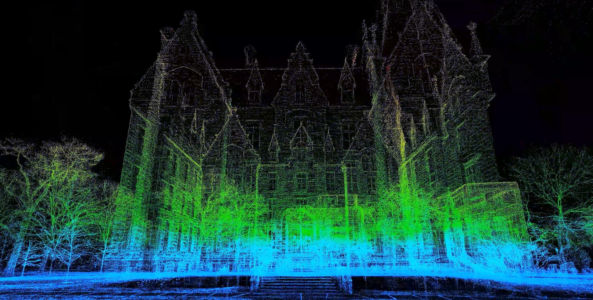
Combining advanced hardware equipment with innovative algorithms, we achieve ultra-high precision 3D modeling, providing excellent 3D data foundation for various fields of digitalization
Using 40-100 million pixel high-resolution lenses and Gaussian splatting algorithms, accurately capture millimeter-level details, perfectly reproduce object surface textures, colors, and fine structures, presenting realistic texture.
Equipped with the latest laser point cloud scanners, professional drones, and panoramic cameras, combined with our self-developed Gaussian splatting algorithms, achieve high-efficiency, high-quality 3D data acquisition and modeling.
Output PLY, 3DTiles, and other standard 3D formats, compatible with various mainstream 3D engines and platforms, meeting the needs of digital display, virtual tours, measurement analysis, and other multi-scenario applications.
Innovative Gaussian splatting technology combined with professional-grade equipment to achieve ultra-high precision 3D modeling
Gaussian splatting 3D modeling technology is an innovative 3D reconstruction method inspired by the sputtering phenomenon in physics, achieving ultra-high precision modeling through the following core steps:
Synchronously acquiring high-resolution images and laser point cloud data to obtain 3D coordinates and texture information of object surfaces
Using Gaussian distribution algorithms to optimize raw point clouds, enhancing point cloud density at edges and details
Through innovative "splatting" algorithms, generating continuous smooth surface models from point cloud data while preserving fine structures
Accurately mapping high-resolution images to 3D model surfaces to achieve extremely realistic visual effects
Generating models with different levels of detail based on application requirements, balancing precision and operational efficiency
Using the latest generation laser scanning technology with point cloud density up to 200 points/mm² and scanning accuracy as high as 0.1mm, perfectly capturing object surface details
Equipped with 40-100 million pixel professional-grade cameras supporting multispectral imaging to accurately reproduce object true colors and textures
Equipped with high-resolution cameras and LiDAR, suitable for rapid acquisition of large-area scenes, cooperating with ground equipment to achieve comprehensive data acquisition
Supporting 360° panoramic acquisition and 720° spatial reconstruction, recording comprehensive environmental information, achieving immersive scene reproduction
Diversified data results and extensive application fields to meet digitalization needs across different industries
Standard point cloud formats such as PLY, PCD, and LAS, including color and normal vector information
Universal 3D model formats such as OBJ, FBX, and GLB with high-resolution textures
Streaming 3D tile formats such as 3DTiles and S3M, supporting efficient loading of large scenes
High-resolution texture atlases, panoramic images, and material parameter files
Object attribute databases, measurement data reports, and technical parameter documents
Constructing high-precision 3D models of campuses and buildings for digital management, virtual display, and planning design
Achieving fine 3D reconstruction of scenic spots and cultural sites to support virtual tourism and cultural heritage protection
Performing high-precision 3D modeling of artifacts to achieve digital archiving, virtual exhibitions, and academic research
Constructing fine 3D models of factory equipment and facilities for digital factory construction and intelligent operation
Providing high-precision 3D models for old residential areas to assist renovation planning, pipeline management, and community services
Performing fine 3D recording of historical buildings and sites to support cultural relic protection, restoration, and digital display
Standardized service process to ensure high-quality delivery of Gaussian splatting 3D modeling projects
Scene characteristics and precision requirements confirmation
Customized acquisition and modeling solution
Multi-source data on-site acquisition
Gaussian splatting algorithm modeling
Model optimization and quality testing
Data delivery and application support
Whether you need to understand the details of 3D modeling technology or want to get a project quote, our professional team will provide you with one-on-one consultation services.
Room 1-1501, Jinhua Garden, No. 385 Jiaotong Avenue, Danyang Street, Xiaonan District, Xiaogan City, Hubei Province, China
(+86)13004585899
service@secondmap.cn
Scan with WeChat