Presenting the project overview from a high oblique perspective, clearly displaying overall planning layout, building forms, transportation networks, landscape greening and surrounding environmental relationships, providing a macro intuitive visual presentation
Aerial view of project overall planning and surrounding environmental relationships
Professional team combined with advanced technology to create project aerial views that combine accuracy and artistic sense, providing strong support for project decision-making and presentation
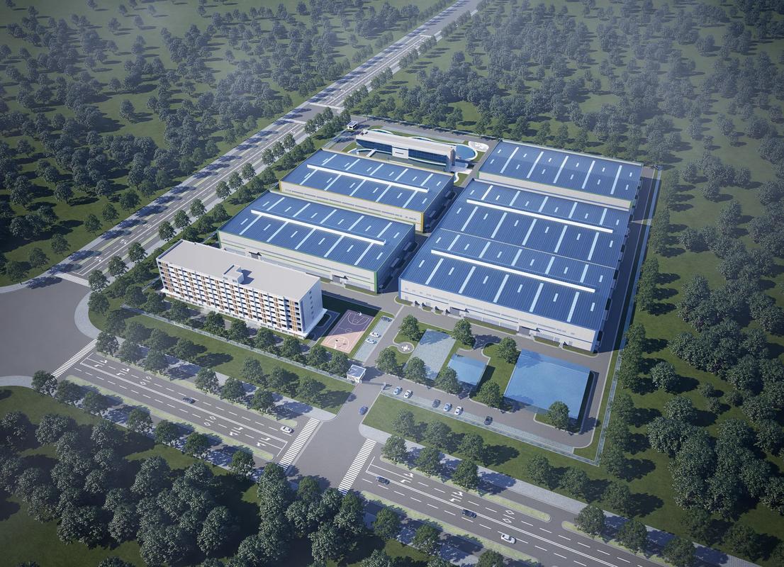
Presenting the complete project overview from a high oblique perspective, clearly displaying overall planning layout, spatial relationships and environmental integration, providing a macro intuitive project preview.
Combining architectural aesthetics with visual arts, through careful lighting design, material presentation and atmosphere creation, presenting highly attractive visual effects.
Accurately presenting key information such as building forms, transportation networks, and landscape greening to ensure that project design intentions and core values are accurately conveyed.
Standardized processes combined with professional-grade tools to ensure aerial views combine accuracy with artistic presentation
Collect and organize project CAD drawings, site models, design schemes and other basic materials, perform data verification and standardized processing
Establish accurate building models, terrain and surrounding environment in professional 3D software to construct a complete 3D scene
Assign realistic material properties to models, perform detailed lighting design, and simulate natural lighting effects and atmosphere creation
Use professional rendering engines for high-resolution rendering to generate base images with photorealistic quality
Perform refined post-processing, add supporting elements such as people, vehicles, and greenery, and adjust colors and atmosphere
Including professional software such as 3ds Max, SketchUp, and Revit for constructing accurate building and environmental 3D models
Using professional rendering engines such as V-Ray, Corona, and Enscape to generate photorealistic images
Using professional image editing software such as Photoshop for post-processing to enhance visual impact and artistic sense
Various professional plugins and resource libraries, including material libraries, model libraries, and scenery libraries, to improve production efficiency and quality
Aerial views serve as the project's "visual blueprint," playing a key role at all stages and creating multi-dimensional value
Provide investors and decision-makers with the most intuitive project preview, clearly displaying overall planning and spatial relationships to assist in planning evaluation and investment decisions
Serve as an efficient and barrier-free communication bridge between designers, developers and clients to ensure consistency in design concepts and expected outcomes
Serve as core materials for pre-project promotion and marketing, intuitively displaying project advantages and characteristics to effectively attract target customers and stimulate purchase or participation willingness
Help identify potential issues in spatial layout, traffic flow, and landscape planning during the design phase, thus enabling optimization and adjustment
Display overall park planning, building layout and landscape environment for park presentation and image promotion
Present urban area planning, transportation networks and public facility layout to assist in planning decisions and public display
Display factory layout, plant distribution and logistics channels for park planning and investment promotion display
Present overall layout and design effects of park and scenic projects to assist in design decisions and display
Display overall layout and flow design of stations and airports to assist in planning and operation management
Present overall planning and business layout of cultural tourism projects for investment decisions and marketing promotion
Whether you need to understand the details of 3D modeling technology or want to get a project quote, our professional team will provide you with one-on-one consultation services.
Room 1-1501, Jinhua Garden, No. 385 Jiaotong Avenue, Danyang Street, Xiaonan District, Xiaogan City, Hubei Province, China
(+86)13004585899
service@secondmap.cn
Scan with WeChat